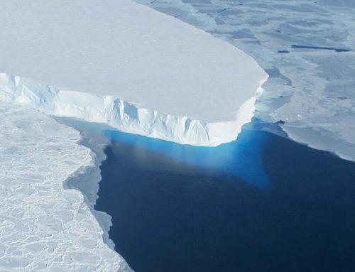
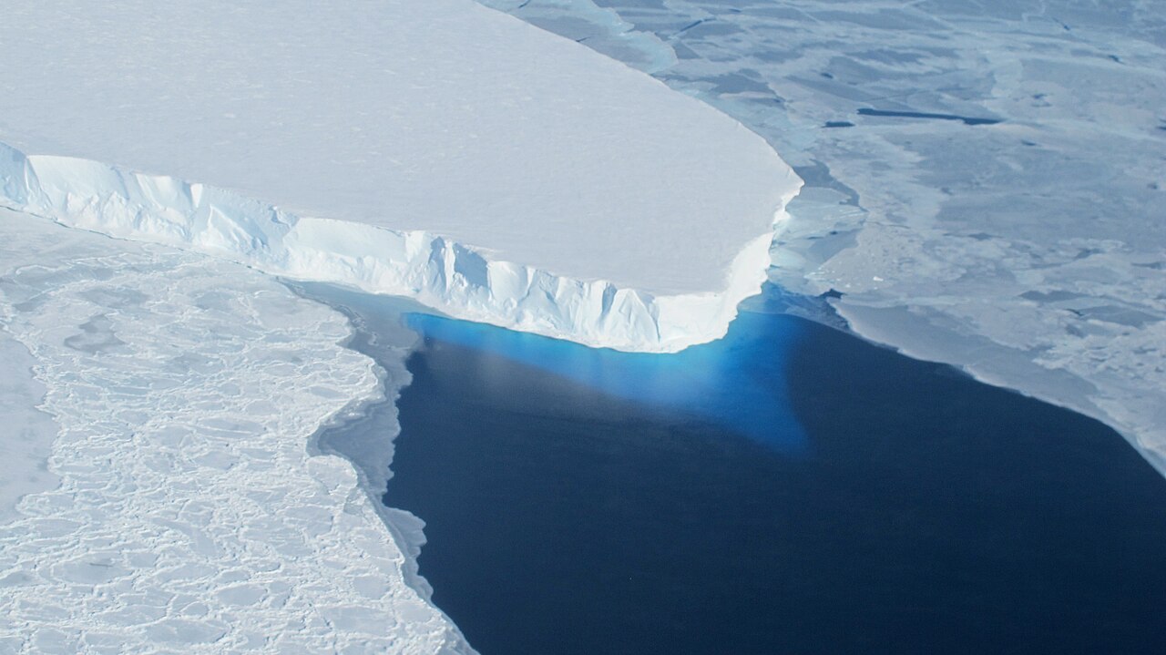
Greenland’s Ice Layers Mapped in 3D
Peering into the thousands of frozen layers inside Greenland’s ice sheet is like looking back in time.

NASA: Each layer provides a record of not only snowfall and melting events, but what the Earth’s climate was like at the dawn of civilization, or during the last ice age, or during an ancient period of warmth similar to the one we are experiencing today. Using radar data from NASA’s Operation IceBridge, scientists have built the first-ever comprehensive map of the layers deep inside the ice sheet.
Categories: Greenland, Ice Sheets, Project, Video
Support Earth Climate

About the Author: EARTH CLIMATE
EARTH CLIMATE covers the broad spectrum of climate change, and the solutions, with the focus on the sciences. Earth Climate – we endorse data, facts, empirical evidence.
Newsletter
Join 117 other subscribers.
Subscribe
Login
0 Comments
Oldest
Newest
Recent Comments
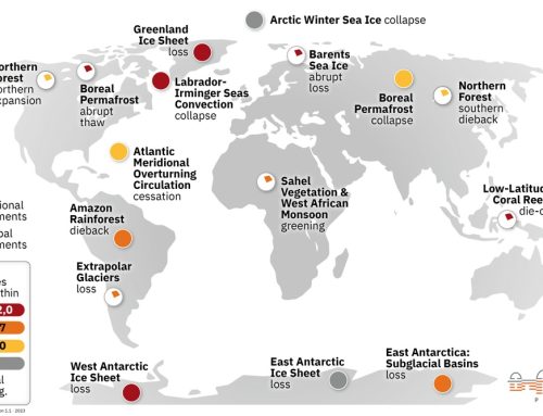
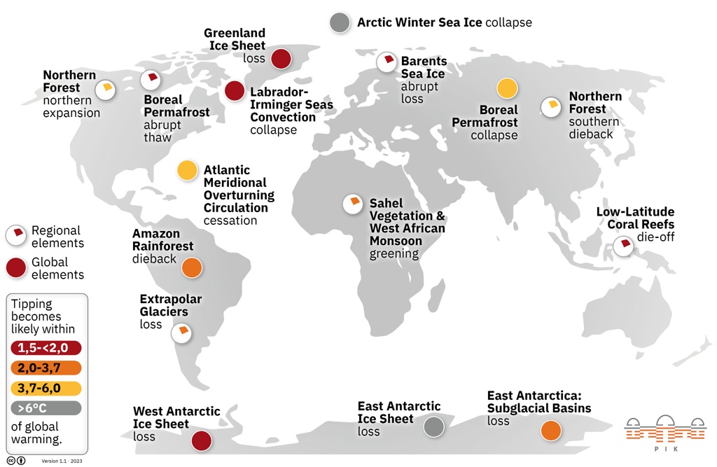
- America’s Climate Free Fall – CounterPunch.org – Theothernews on Climate Free Fall: Scientists Warn of Hidden Economic Crisis, Earth’s Systems Become Dangerously Unstable
- Climate Researcher Levermann: "We Must Understand What Happens After Climate Systems Tip" | EarthClimate on Climate Free Fall: Scientists Warn of Hidden Economic Crisis, Earth’s Systems Become Dangerously Unstable
- Extreme Temperature Diary- Saturday July 18th, 2026/Main Topic: The “Super” El Niño of 2026: Why 2027 Will Be a Year That Is Off the Chain Hot – Guy On Climate on The “Super” El Niño of 2026: Why 2027 Will Be the Year the World Watches
Support
We create visually compelling, accessible science content that transforms complex research into engaging videos and articles, helping millions understand the discoveries shaping our world. [Paypal | Patreon]