Hurricane Harvey’s Destructive Path Time Lapse
At 1:00 pm CDT, NOAA’s National Hurricane Center reported that Tropical Storm Harvey is about 40 miles east-northeast of Port O’Connor, Texas, and drifting erratically toward the east-southeast. A slow motion toward the southeast is expected later today through tonight and a gradual turn toward the northeast and a continued slow forward speed are expected Tuesday and Tuesday night (8/29).

The center of Harvey is expected to be just offshore of the middle and upper coasts of Texas through Tuesday night. Harvey’s maximum sustained winds are near 40 mph (65 km/h) with higher gusts and forecasters say some slow intensification is possible during the next 48 hours. https://www.youtube.com/watch?v=pnTN6b1QoL8
Hurricane Harvey continues toward the Texas coast in this GOES-16 geocolor imagery https://www.youtube.com/watch?v=z7UZ-a5FYPQ

Support Earth Climate

About the Author: EARTH CLIMATE
Newsletter
Recent Comments
- America’s Climate Free Fall – CounterPunch.org – Theothernews on Climate Free Fall: Scientists Warn of Hidden Economic Crisis, Earth’s Systems Become Dangerously Unstable
- Climate Researcher Levermann: "We Must Understand What Happens After Climate Systems Tip" | EarthClimate on Climate Free Fall: Scientists Warn of Hidden Economic Crisis, Earth’s Systems Become Dangerously Unstable
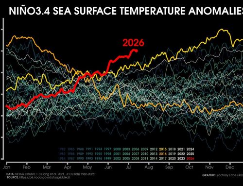
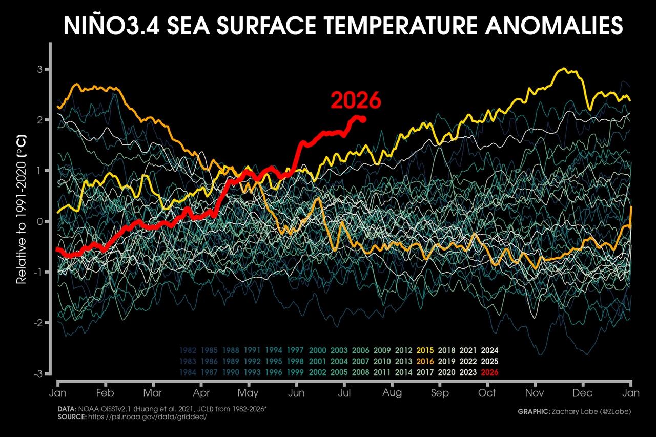
- Extreme Temperature Diary- Saturday July 18th, 2026/Main Topic: The “Super” El Niño of 2026: Why 2027 Will Be a Year That Is Off the Chain Hot – Guy On Climate on The “Super” El Niño of 2026: Why 2027 Will Be the Year the World Watches
Support
We create visually compelling, accessible science content that transforms complex research into engaging videos and articles, helping millions understand the discoveries shaping our world. [Paypal | Patreon]